See it in action
Real telemetry.
Real corners.
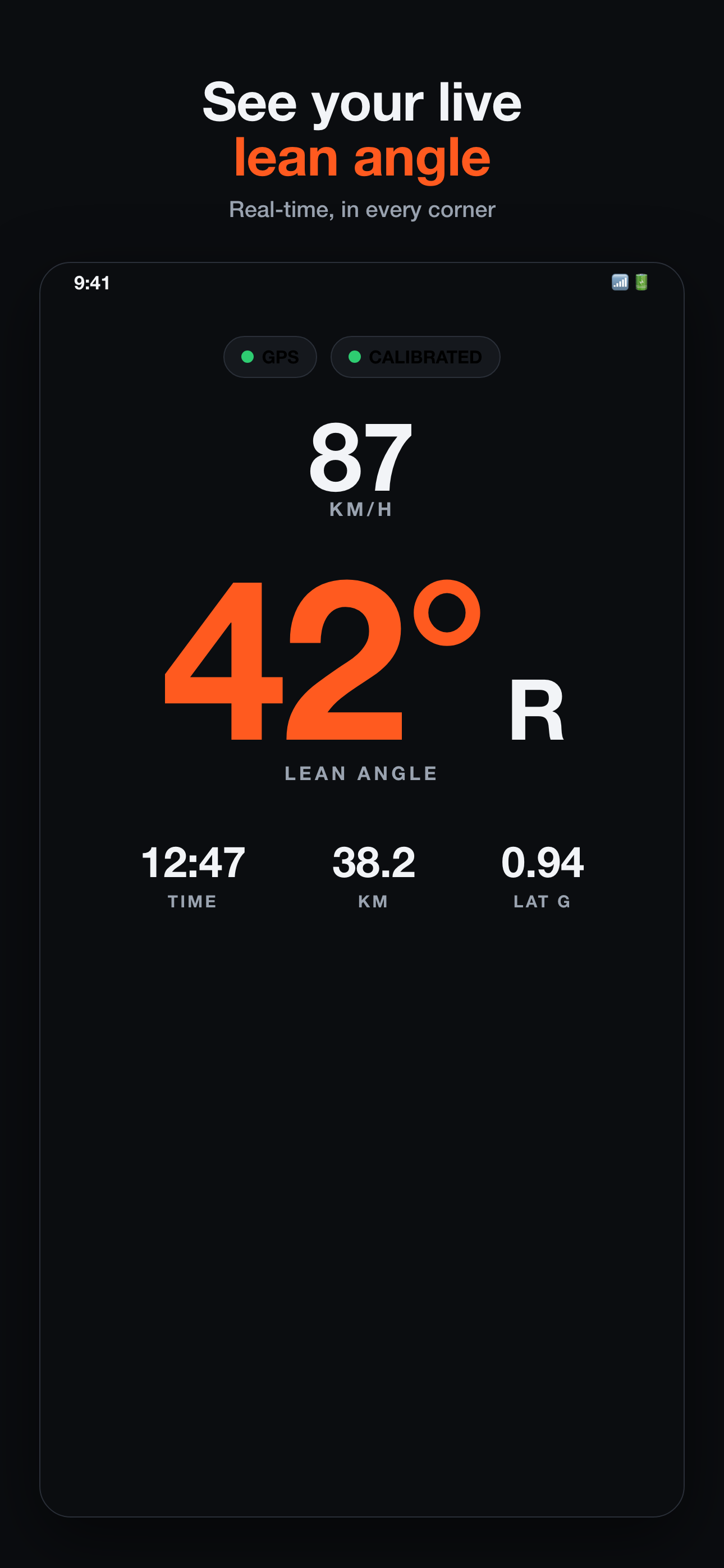
Live lean angle, speed and G-force - the actual app, straight from the road.
And 43° on the left. Every rider has a weak side.
Apex reads the lean angle out of your phone, corner by corner, and hands it back as a number you can actually do something about. Mount it, calibrate, ride.
Free to download on iPhone. Records offline. Your rides stay yours.
Live lean angle, speed and G-force - the actual app, straight from the road.
Portrait on the bars, landscape in a cradle, or flat in your jacket pocket - Apex detects the orientation and sets its own zero. Wait for vertical set, hit START, ride.
No sensor to buy, no wiring, no bracket that rattles loose at 6,000 rpm. The phone you already mounted is the instrument.
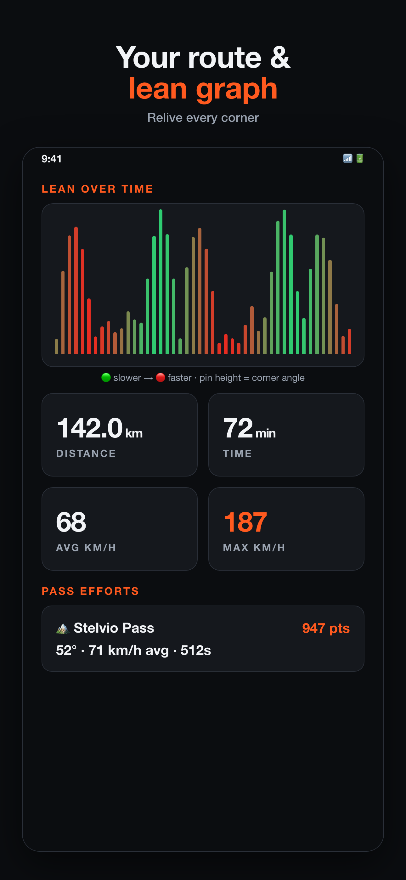
Your route comes back coloured by speed - green where you dawdled, red where you didn't - and every pin along it holds the angle you carried through that corner.
Underneath, speed broken down section by section, so the road stops being one number and starts being a sequence of decisions.
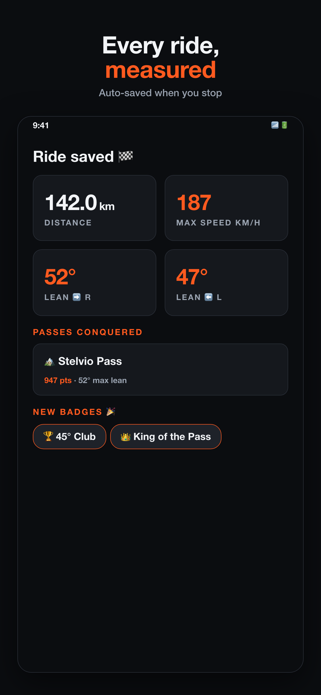
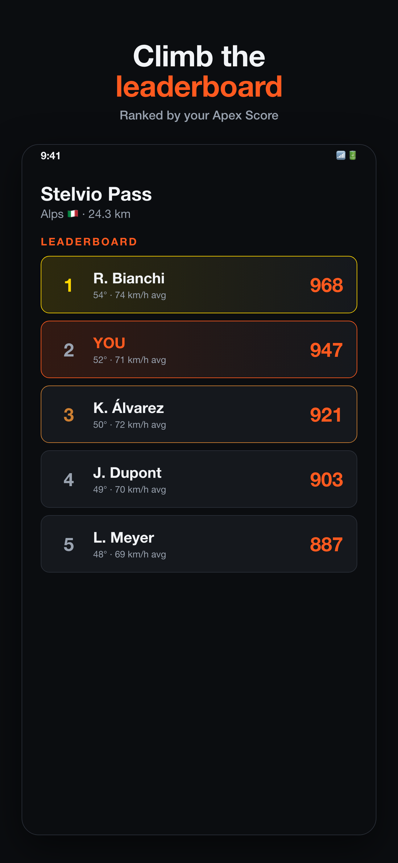
A Pass is a stretch of road with a beginning and an end - Scorpions Ascent, the Meron descent, Stelvio. Ride it and it's timed, scored and yours to defend.
Ridden something the map doesn't know about? Make it a Pass and it becomes a challenge for everyone who comes after you.
Apex Score weighs your line, your consistency and how much of the corner you used. It's the number that rewards riding a road well, rather than simply surviving it quickly.
Ride a known circuit and apex recognises it - thousands of tracks across two dozen countries - and shows your session there.
Start a group ride and share the link. Everyone sees who is behind, who has gone quiet and who has left the route.
Add an emergency contact. If apex detects a crash and you don't respond, it sounds an alarm and gets a text with your location ready for them.
A heads-up the evening before a genuinely good day to ride where you ride - dry, mild and calm - and nothing on the days that aren't.
Your photo on top, your route and lean angle below it - ready for Instagram in one tap.
Traction circle, tip-in rate, hardest braking and the phases of every corner, for riders working on technique.
Anywhere you can hold it still. Apex auto-detects portrait, landscape or pocket and calibrates to that position. Mounted rigidly is the most accurate; pocket mode is looser, and it says so.
Within about ±2° once calibration reads 100% and the phone can't shift in its cradle. Anything measured below walking pace, or while you're waving the phone around in a car park, isn't a lean angle and doesn't count.
No. No sensor, no dongle, no subscription to a box that lives under your seat. The phone you already mounted has the accelerometer and gyroscope Apex needs.
A defined stretch of road with a start and an end. Ride through one and Apex recognises it automatically. You can also turn any ride of your own into a Pass for others to take on.
Yes. Everything records offline and uploads when you're back in range. If a ride hasn't uploaded, it tells you rather than losing it.
apex is free to download and every ride you record is saved. The lean angle, score and the rest come with apex Pro - $39.99 a year, or 3-month, monthly and weekly plans in the app. See pricing.
No. Your rides are yours. Export them or delete them, any time.
Apex is on iOS today. Leave your email and we'll send you the Play Store link the day Android drops - one message, nothing else.
No spam. Just the Android launch.